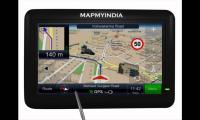
Genesys Map: Official Ayodhya Guide for Pilgrims
Genesys International's 3D map chosen as the official Ayodhya map, offering pilgrims and visitors accurate navigation and insights. Learn about its features & impact on the city.
New Delhi, Jan 9 (PTI) Ahead of the opening of the grand temple at Ayodhya, Genesys International's high-precision three-dimensional map of roads and immovable structures has been chosen as the official map of the city to provide pilgrims and visitors with accurate information.
Along with other applications, the map will go a long way in making Ayodhya a smart and sustainable city for pilgrims, citizens, and authorities, the company said in a statement.
The Ayodhya Development Authority has chosen Genesys' new India map platform as the official map for Ayodhya city, it said.
"The Genesys Ayodhya map not only will provide optimal routes and locations but also includes special features catering to electric vehicles, aligning with Ayodhya's commitment to environmental sustainability," it said.
"The project will carry exceptional features, including an advanced 3D mapping system asking with navigation and a unique change detection feature. This feature empowers authorities to track and monitor changes swiftly, facilitating rapid deployment of resources and infrastructure where needed," it said.
Genesys Chairman and Managing Director Sajid Malik said, "Adoption of the Genesys New India Map stack for one of the most historic developments in our country wherein the area is expected to witness large footfalls and also infrastructure development is a great testimonial to the power of the map platform Genesys has developed."
Genesys International is one of the leading homegrown players in mapping technology solutions. Their New India map platform integrates cutting-edge 2D navigation and a 3D digital twin of the entire city, offering an unparalleled and immersive experience for users.
Genesys International's advanced 3D mapping features and its security applications for disaster management and emergency response are poised to play a vital role in transforming Ayodhya's navigational landscape, further solidifying the company's position as a key player in the emerging geospatial market in India.
"The Ayodhya Development Authority is gearing up to launch the Ayodhya Development Authority app on all platforms, inviting citizens to explore the city in its full glory through the Genesys mapping interface. As Ayodhya evolves into a smart city, Genesys International remains at the forefront, providing innovative solutions for a connected and sustainable future," the statement said.
Genesys is a premier advanced mapping company that is building the new India map stack.
You May Like To Read
TODAY'S MOST TRADED COMPANIES
- Company Name
- Price
- Volume
- Vodafone-Idea-L
- 11.65 (+ 3.56)
- 106772451
- Alstone-Textiles
- 0.28 ( -3.45)
- 44187760
- Mangalam-Industrial
- 0.88 ( -2.22)
- 39177573
- Sunshine-Capital
- 0.27 (+ 3.85)
- 35956340
- GMR-Airports
- 104.40 (+ 6.37)
- 30453005


